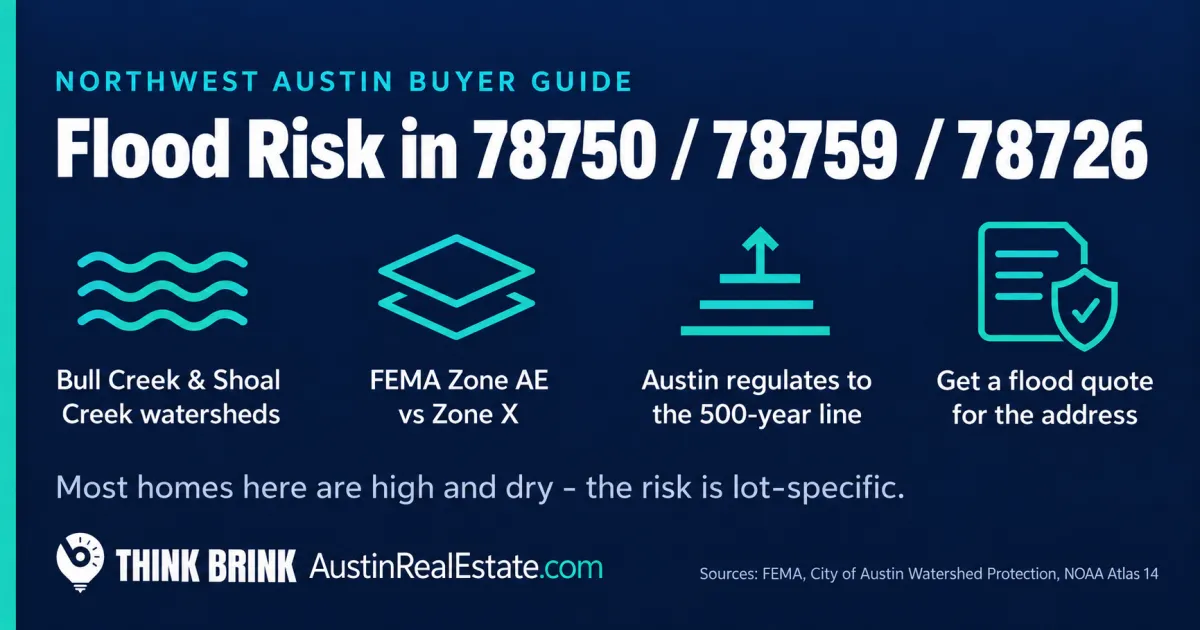
Flood and Floodplain Risk in 78750, 78759, and 78726: What Northwest Austin Buyers Should Actually Check
Most of Northwest Austin sits high, hilly, and well-drained. If you are moving here from Houston or the Gulf Coast, your mental picture of flooding, whole subdivisions underwater for days, mostly does not apply to 78750, 78759, and 78726. The land tilts, water runs off fast, and the large majority of homes in these zip codes are not in any mapped floodplain.
That is the reassuring half of the story, and it is true. The problem is that it makes a lot of buyers stop asking questions, and the flood risk that does exist here is specific, concentrated, and easy to buy right into if you are not looking for it. This is the Balcones Escarpment, the geographic seam that makes Central Texas the most flash-flood-prone region in the country. The same hills that keep your house dry send water off them with real force, into a small number of creeks and crossings that flood hard and fast. A home three streets away from a creek can be a non-issue. A home backing to that creek, or on a street that drains to it, is a different purchase entirely.
This is a practical guide to how flood and floodplain risk actually works in Northwest Austin, which creeks and neighborhoods it touches, how to read the FEMA maps and Austin's stricter local rules, and exactly what to check before you write an offer. It is written for buyers, but sellers and current owners should read the insurance and disclosure sections too, because the maps here are being redrawn right now.
The thing most buyers get backwards about flood risk here
The instinct is to treat "flood zone" as a yes-or-no property label, the way you would treat a school district. It is not. There are two different kinds of flooding in Austin, and the FEMA map only describes one of them.
The first is creek flooding, when a creek or river overflows its banks. This is what the FEMA floodplain maps are drawn around, and in Northwest Austin it follows a handful of specific waterways rather than spreading across whole neighborhoods.
The second is local flooding, when rain falls faster than the streets, storm drains, and culverts can carry it away. Local flooding does not respect the creek maps. It shows up at low points in the road, at undersized culverts, in yards that sit below their neighbors, and at the bottom of long driveways on hillside lots. A home can be nowhere near a mapped creek floodplain and still take water in a hard storm because of where it sits on its own block.
Central Texas gets both, and it gets them violently. This region routinely produces some of the heaviest short-duration rainfall in the United States, the kind that drops several inches in a couple of hours. The hills that define Northwest Austin are exactly what turn that rain into fast-moving water. So the honest framing is not "is this house in a flood zone." It is "where does water go when it rains hard here, and is this house in its path."
The creeks that actually shape flood risk in Northwest Austin
Flood risk in these zip codes is a story about a few watersheds. Knowing which one a home drains into tells you more than almost anything else.
Bull Creek and the western side
Bull Creek is the defining watershed of western and northern Northwest Austin. It drains a large share of the area, and its boundaries are framed by roads you already know: Research Boulevard (183), Loop 360, RM 620, and RM 2222. It runs down toward Lake Austin, and a substantial portion of the watershed, roughly 40 percent, overlaps the Balcones Canyonlands Preserve, which is why so much of the western edge stays undeveloped.
For buyers, Bull Creek matters in two ways. First, homes on lots that back to the creek or its tributaries, or that sit low in the drainage, carry genuine creek-flooding exposure and need to be checked against the map individually. Second, and this catches people off guard, Bull Creek shapes the commute as much as the lot. Spicewood Springs Road cuts through the heart of this watershed and crosses the creek and its branches at a series of low-water crossings. Old Spicewood Springs Road in particular has long been one of the most flood-prone stretches in the city, with crossings that go underwater in even modest storms. Residents on the north and west side of Loop 360 simply expect that heavy rain will close their road for a while. If you are touring homes off Spicewood Springs on a dry, sunny Saturday, that risk is invisible. It is very real on the third rainy morning of a wet spring.
Shoal Creek and the central-eastern corridor
On the eastern and central side of the footprint, Shoal Creek is the watershed that matters. It is the largest of Austin's north urban watersheds, on the order of 13 square miles, with headwaters up near The Domain that flow south through the city all the way to Lady Bird Lake. Because Shoal Creek runs through older, more built-out ground with a lot of impervious cover, it responds fast. In one 2022 storm, several inches of rain in a few hours pushed Shoal Creek to its highest level in years. Homes along the creek corridor and its feeder tributaries are the ones to scrutinize.
Walnut Creek, Rattan Creek, and the tributaries
North and east, Walnut Creek and its tributaries drain much of the tech-corridor ground toward 78727, 78729, and 78758, and there are documented spots where homes along small tributaries have flooded repeatedly until the city upgraded a culvert or a crossing. The lesson is not that any one neighborhood is bad. It is that flood risk here is a lot-by-lot and block-by-block question tied to small creeks and drainage paths, not a blanket property of a zip code. Two houses in the same subdivision, one on high ground and one at the bottom of the swale, are not the same flood purchase.
FEMA flood zones, in plain English
When you or your lender pull a flood determination, you will see a zone letter. Here is what the ones you will actually encounter in Northwest Austin mean.
Zone AE is the mapped 100-year floodplain, which is a confusing name. It does not mean a flood every hundred years. It means roughly a 1 percent chance of a flood reaching that level in any single year. Over a 30-year mortgage, that adds up to a meaningful cumulative probability. If a home is in Zone AE and you have a federally backed mortgage, your lender will require flood insurance. AE zones here track the creeks described above.
Zone AO shows up for shallow sheet-flow flooding, typically along the path where water spreads out at a depth of a foot or two rather than pooling deep. It is less common in the footprint but does appear.
Zone X is everything outside the mapped 100-year floodplain, and it is where the large majority of Northwest Austin homes sit. But Zone X is not one thing. Shaded Zone X is the 500-year floodplain, meaning roughly a 0.2 percent annual chance of flooding, plus areas protected by drainage but still at some residual risk. Unshaded Zone X is minimal risk. Lenders do not mandate flood insurance in Zone X, but as you will see below, "not required" and "not at risk" are two different statements, and here they diverge more than in most cities.
Why Austin regulates to the 500-year floodplain, and why that surprises people
This is the local rule that trips up buyers and even agents from out of town. In 2018, a national rainfall study called NOAA Atlas 14 concluded that Central Texas storms are considerably heavier than the older data assumed. The old estimate of a "100-year" rain here turned out to be closer to what newer data would call a much more frequent event. Austin responded in late 2019 by changing its floodplain regulations to govern development based on the FEMA 500-year floodplain rather than the 100-year line.
What that means in practice: the boundary the City of Austin uses to regulate what you can build, add on to, or substantially remodel is wider than the FEMA line that triggers mandatory insurance. So a home can sit outside the FEMA 100-year zone, carry no lender insurance requirement, and still fall inside the city's regulated 500-year floodplain, which can affect a future addition, a pool, or a major remodel. If your plan for a house involves changing its footprint, this is not a detail. Check the city's regulatory floodplain, not just the FEMA determination, before you assume you can build what you are picturing.
The maps are being redrawn right now
Flood maps are not permanent. FEMA has been working through a multi-year update to Austin's Flood Insurance Rate Maps, and that work has been active into 2025 and 2026. Updated mapping reflects heavier modern rainfall, and the direct consequence is that some properties currently sitting in Zone X are being moved into Zone AE, the mandatory-insurance floodplain.
For a buyer, this is a timing and due-diligence issue with real dollars attached. A home that shows as "not in a flood zone" today could be remapped into AE during your ownership, at which point a federally backed loan would require flood insurance you had not budgeted for. It cuts the other way too: some properties get mapped out. The point is not to panic, it is to check the current status and ask whether the property is in an area under active remapping, rather than treating a determination as settled for the life of the loan.
What the Texas seller's disclosure tells you, and what it doesn't
Since September 1, 2019, Texas has required an expanded flood section on the seller's disclosure notice, the result of a law known as SB 339. On the current form, sellers must answer whether the property is located wholly or partly in a 100-year or 500-year floodplain, whether it is in a flood pool or near a reservoir, whether it has flooded before, whether they have filed a flood insurance claim, and whether they have received federal disaster assistance for flood damage.
This is genuinely useful, and it is one of the first documents I want in hand during the option period. But understand its limits. The disclosure is based on the seller's knowledge. A seller who bought recently, or who never experienced a big storm, or who simply is not sure, can answer honestly and still leave you without the full picture. It is a starting point for your own verification, not a substitute for it. If a disclosure notes prior flooding or a prior claim, treat that as a serious flag worth a professional look, not a dealbreaker to reflexively run from, but not something to wave off either.
Flood insurance under Risk Rating 2.0: why "am I in a flood zone" is the wrong question
FEMA overhauled how it prices flood insurance under a system called Risk Rating 2.0. The old world priced largely off your zone. The new world prices off the specific property: its distance to water, its elevation, the cost to rebuild it, and the types of flooding it could see. Two homes in the same zone can carry very different premiums, and a home in Zone X can still be quoted a real premium because the model sees real risk.
The practical takeaways for Northwest Austin buyers are straightforward. First, in Zone AE, a lender on a federally backed loan will require flood insurance, so build it into your monthly number before you fall in love with the house. Second, in Zone X, insurance is optional, but optional does not mean unnecessary, and given how this area floods locally, a quote is cheap information. Get one during the option period regardless of the zone, alongside the rest of your homeowners insurance homework. Third, because pricing is now property-specific, do not estimate from a neighbor's premium or an online average, get an actual quote for the actual address. And fourth, private flood insurance has become a competitive alternative to the federal NFIP program for many Austin homes and is often worth comparing. I am a broker, not an insurance agent, so treat this as general information and get real numbers from a licensed agent, but the framing matters more than any single dollar figure: the right question is not "is this house in a flood zone," it is "what does it cost to insure this specific house against flooding, and what happens to that cost if the map changes."
What to actually check before you make an offer
Here is the diligence I would run on any Northwest Austin home where flood risk is even a question, most of which fits inside a standard option period:
- Pull the current FEMA determination for the exact address, using FEMA's Flood Map Service Center at msc.fema.gov. Zone, and whether the property is split across zones, is the baseline fact.
- Check the City of Austin's regulatory floodplain, not just FEMA's. Austin regulates to the 500-year line, so use the city's online flood map viewer to see whether the lot touches the regulated floodplain, which matters for any future build or remodel.
- Ask whether the area is under active FEMA remapping. If a Zone X home could become Zone AE, you want to know before closing, not after.
- Walk the lot with drainage in mind. Where is the low point? Does the yard slope toward the house or away from it? Is the home at the bottom of a hill, a swale, or a long driveway that funnels water to the front door? On a hillside or view lot, this is often the whole ballgame.
- Read the seller's disclosure flood section closely and follow up on any prior flooding, prior claim, or disaster assistance.
- Check the commute for low-water crossings. If the route to your house crosses Bull Creek or its tributaries, especially anything off Spicewood Springs Road, know that heavy rain can close it. The real-time low-water-crossing status for the Austin area is published at atxfloods.com.
- Get an actual flood insurance quote for the address, in any zone, before your option period ends.
- If the home is creek-adjacent or in a mapped zone, consider an elevation certificate. It documents the home's elevation relative to the flood level and can materially change the insurance math.
What this means for you
Northwest Austin is not a high-flood-risk area in the way coastal Texas is, and buyers should not let flooding scare them off a region that is, for the overwhelming majority of homes here, high and dry. But the risk that exists is real, it is specific, and it is the kind that rewards a little homework and punishes a blank stare at a sunny-day showing. The difference between a smart flood-aware purchase and an expensive surprise is almost always a lot-level question: which creek does this drain to, where does this house sit on its block, is it in the FEMA line or just the city's, and what does it actually cost to insure. Flood is one of two natural-hazard questions worth asking on the western edge of the footprint; the other, wildfire risk and insurance on the wildland edge, deserves the same lot-level look.
If you are weighing a specific home in 78750, 78759, or 78726 and want a straight read on its flood exposure, the map, the drainage, the insurance, and how it should shape your offer, that is exactly the kind of thing I help buyers think through. It is worth getting right before you sign, not after the first big storm.
This article is general information for Northwest Austin buyers and owners, not flood-risk, insurance, engineering, or legal advice. Verify any property's flood status against the current FEMA and City of Austin maps, and get flood insurance quotes and any elevation determination from licensed professionals for the specific address.
Frequently Asked Questions
Is Northwest Austin a flood zone?
Most of Northwest Austin, including the bulk of 78750, 78759, and 78726, sits outside the mapped FEMA 100-year floodplain on hilly, well-drained ground. The flood risk that exists is concentrated along specific creeks such as Bull Creek and Shoal Creek and their tributaries, and in low spots prone to local street flooding. It is a lot-by-lot question, not a blanket zip-code answer, so always check the exact address.
Do I need flood insurance in 78750, 78759, or 78726?
If the home is in FEMA Zone AE and you have a federally backed mortgage, your lender will require it. If the home is in Zone X, it is not required, but given how hard Central Texas storms can hit, a quote is still worth getting. Under FEMA's Risk Rating 2.0, premiums are priced on the specific property rather than the zone, so get an actual quote for the actual address and compare the federal NFIP program against private flood insurance.
What is the difference between the 100-year and 500-year floodplain in Austin?
The 100-year floodplain (FEMA Zone AE) has roughly a 1 percent chance of flooding in any given year and triggers mandatory insurance on federally backed loans. The 500-year floodplain has about a 0.2 percent annual chance and shows as shaded Zone X. Austin is unusual in that, after the NOAA Atlas 14 rainfall study, it changed its rules in 2019 to regulate development to the 500-year line, so the city's regulated floodplain is wider than the FEMA insurance line.
Why does Austin use the 500-year floodplain when FEMA uses the 100-year?
The NOAA Atlas 14 study found that Central Texas rainfall is heavier than older data assumed, meaning the historic "100-year" storm here is more frequent than the name suggests. Austin responded in late 2019 by regulating floodplain development to the FEMA 500-year boundary to better reflect real risk. It affects what you can build or substantially remodel, so check the city's regulatory floodplain before planning an addition or pool.
Are Austin flood maps changing?
Yes. FEMA has been running a multi-year update to Austin's Flood Insurance Rate Maps that has been active into 2025 and 2026, and it reflects heavier modern rainfall. Some properties currently in Zone X are being moved into Zone AE, which would trigger a flood insurance requirement on a federally backed loan. Before buying, check the current determination and ask whether the property is in an area under active remapping.
Does a Texas seller have to disclose flood risk?
Yes. Since September 1, 2019, under SB 339, the Texas seller's disclosure notice includes an expanded flood section. Sellers must state whether the property is in a 100-year or 500-year floodplain, in a flood pool or near a reservoir, whether it has flooded before, whether a flood insurance claim was filed, and whether federal flood disaster assistance was received. The disclosure is based on the seller's knowledge, so use it as a starting point and verify independently.
Which roads flood in Northwest Austin?
The best-known trouble spot is the set of low-water crossings on Spicewood Springs Road, especially Old Spicewood Springs Road north and west of Loop 360, where Bull Creek and its tributaries cross the road and can close it during heavy rain. Low points on many surface streets can also pond in intense downpours. Check real-time low-water-crossing closures for the Austin area at atxfloods.com, and factor road flooding into a commute, not just the house.
Can a home flood even if it is not in a flood zone?
Yes, and in Central Texas this is common. FEMA maps describe creek flooding, but homes also take water from local flooding when rain overwhelms streets, storm drains, and culverts. A house at the bottom of a hill, in a swale, or below its neighbors can flood locally while sitting well outside any mapped creek floodplain. Walk the lot with drainage in mind, and do not treat a clean flood-zone determination as proof the home cannot flood.
