What Relocating Buyers Should Know About Wildfire Risk and Insurance on Northwest Austin's Wildland Edge
Buyers relocating to Northwest Austin from California, the Pacific Northwest, or Colorado often arrive already fluent in wildfire risk, and they ask about it directly. Buyers coming from flatter, wetter parts of the country almost never think to ask, and then they are surprised when an insurance quote comes back higher than expected, or when a carrier asks for photos of the vegetation around the house. Both groups need the same thing: a clear, honest picture of what wildfire risk actually looks like on the western edge of Austin, and what it means for insurance, inspections, and the specific home you are considering.
This is not a scare piece. Most of Northwest Austin is not a high-hazard wildfire property, and thousands of families live comfortably at the wildland edge every year. But the risk is real on specific streets, it is now formally mapped, and it increasingly shows up in what you pay to insure a home and, in some cases, whether a carrier will write the policy at all. Here is what buyers should understand before they make an offer near Austin's wildland edge.
Why Northwest Austin has genuine wildfire exposure
The short version is geography. Austin sits on the Balcones Escarpment, the line where the flat eastern blackland prairie meets the hills and canyons of the Hill Country to the west. Northwest Austin, my primary geography in the 78750, 78759, and 78726 zip codes, sits right along and above that line. The steep canyons on the city's west side are blanketed in Ashe juniper, the tree everyone here calls cedar, along with live oak and grass. During drought those fuels are volatile and carry fast fire, while the flat eastern side of the city is materially lower hazard.
This is not a fringe concern. Austin ranks among the highest urban areas at risk of wildfire in the country. According to the Austin Fire Department, wildlands cover roughly 59 percent of Travis County and 36 percent of the City of Austin, and federal analysis has found that a large majority of Travis County structures, and roughly half of Austin structures, sit within the wildland-urban interface, the zone where homes meet or intermingle with wildland vegetation. Historically, homes in West Austin have carried the greatest wildfire risk, and Northwest Austin's canyon-edge neighborhoods are part of that pattern.
The risk is also concentrated, not uniform. A home on an interior lot in an established, well-irrigated neighborhood with mature lawns and spaced-out canopy is a very different risk than a home perched on a canyon rim backing to unmanaged juniper. That distinction is the entire point of this guide, because it is the distinction insurers are now making too.
Austin formally expanded its wildfire map, and it matters for buyers
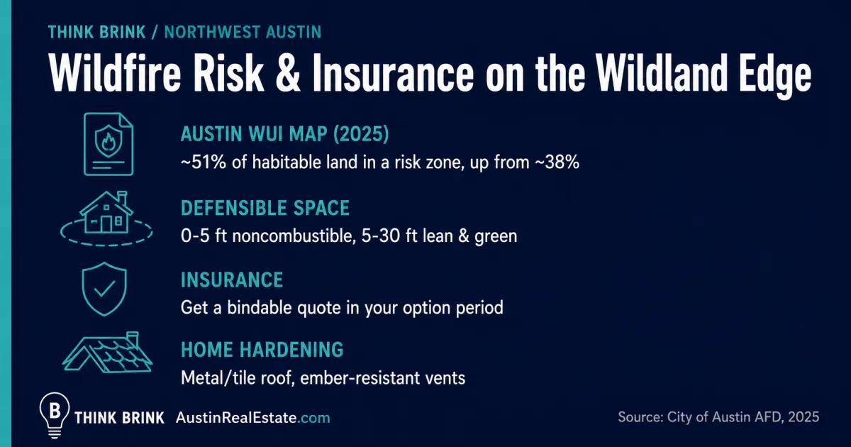
In 2025 Austin adopted a new wildland-urban interface map and an updated WUI code, and the change was significant. The latest map places roughly 51 percent of Austin's habitable land in a wildfire risk zone, up from about 38 percent nearly a decade earlier. That expansion pulled in neighborhoods that were not previously mapped as at-risk, including pockets across Northwest Austin.
The practical meaning for a buyer is twofold. First, more homes now sit inside a formally designated risk zone, which is information insurers, appraisers, and future buyers can all see. Second, the updated building code carries real construction requirements, so it is worth understanding exactly when those requirements apply.
When the WUI code actually applies
This is where buyers get confused, so it is worth being precise. Austin's updated WUI code applies to new construction and to development or permit applications submitted on or after July 10, 2025. It requires homes built in the designated interface and proximity zones to use ignition-resistant construction materials, to resist ember intrusion, and to maintain defensible space, generally at least 30 feet from the structure or to the property line, whichever is less, subject to site-specific adjustment by the code official.
Existing homes do not have to be brought up to the new code. If you buy an established house in the WUI, you are not required to retrofit it. However, the code does apply to the portions of an existing home that you remodel or replace, and to any new construction. So if you buy a canyon-edge home and plan a major addition or a re-roof, expect the wildfire provisions to come into play for that work. This is general information, and your builder, an architect, or the City's Development Services team can confirm exactly what applies to a specific property and project.
What wildfire risk does to your insurance
For most buyers, the place wildfire risk shows up first is not a fire. It is the insurance quote. Carriers have gotten far more granular about wildfire exposure, and they now assess it close to the parcel level using the home's location, the surrounding vegetation, and the defensible space around the structure.
Three things are worth knowing before you shop for a canyon-edge home.
Premiums can be meaningfully higher near the wildland edge
A home backing to unmanaged wildland in a mapped risk zone can carry a higher premium than a comparable interior home a mile away, sometimes noticeably so. This does not make the home a bad buy, but it belongs in your monthly-cost math from the start, right alongside property taxes. Do not wait until you are under contract to find out what the insurance costs.
Some carriers non-renew or decline high-risk properties
In recent years, homeowners in wildfire-exposed areas around the country have faced non-renewals and declined applications as carriers reassess risk. This is less severe in Texas than in the hardest-hit parts of California, but it is a live issue, and a home in a high-hazard zone with no defensible space and combustible landscaping right against the structure is exactly the profile a carrier scrutinizes. If a home's current owner has a policy, ask which carrier and whether they have had any renewal issues.
Mitigation can change the quote
The encouraging part is that wildfire risk is not purely a function of location. Insurers increasingly reward, and sometimes require, defensible space and home hardening. A home with a metal or tile roof, ember-resistant construction, and cleared defensible space is a better insurance risk than an identical home with a wood-shake roof and juniper growing against the foundation. Some of this you can verify or improve before you close. Because coverage terms, pricing, and availability change constantly, confirm the specifics with a licensed insurance agent. I am a real estate broker, not an insurance professional, and this is general information rather than insurance or legal advice.
Get a real insurance quote before you remove your option period
This is the single most useful thing in this guide, so I am giving it its own section. If you are buying anywhere near Austin's wildland edge, get an actual bindable insurance quote on the specific address during your option period, not a rough estimate and not a quote for a different house you owned somewhere else.
The reasons are practical. The quote tells you the true monthly cost so your budget is real. It surfaces any carrier concern about the property before you are committed. And in the rare case where a home is genuinely difficult to insure, you find out while you can still walk away rather than after closing. Buyers relocating from lower-risk states are the ones most likely to skip this step, and they are the ones most likely to be surprised. Fifteen minutes with an agent during your option period removes the surprise.
Reading a specific home's wildfire risk before you offer
Just as with golf-course lots or hillside lots, wildfire risk is a property-by-property question, not a neighborhood label. Two homes on the same street can carry very different risk depending on where they sit and how the vegetation is managed. Here is what to look at.
- What the home backs onto. A home backing to open, unmanaged juniper canyon or to the Balcones Canyonlands Preserve is a different risk than one backing to an irrigated greenbelt or another house. My guide to living near the Balcones Canyonlands Preserve covers the preserve edge specifically.
- The defensible space around the structure. Look at the first 5 feet, which should ideally be noncombustible with no wood mulch, stored firewood, or dense shrubs against the walls, and the first 30 feet, which should be lean and well-maintained. A home with juniper growing to the foundation is both a higher fire risk and a harder insurance case.
- The roof and exterior materials. A metal or tile roof and ignition-resistant siding are meaningfully more fire-resilient than wood shake and untreated wood. This is also one of the biggest levers on an insurance quote.
- Overhanging limbs and fire ladders. Branches within 10 feet of the roof and lower limbs on tall trees that let ground fire climb into the canopy are exactly what mitigation guidance targets. They are also fixable.
- Slope and position. Fire moves faster uphill. A home at the top of a canyon slope with fuel below it faces a different exposure than one on flatter ground. My guide to buying a hillside or view lot covers the terrain side of this.
- Access and egress. Narrow, single-entry canyon streets matter for both evacuation and fire-truck access. It is worth knowing how you would get out.
You can also check a property's mapped risk directly. The City of Austin publishes its WUI map, and the Texas A&M Forest Service maintains a statewide wildfire risk assessment portal, both of which let you look up a location. Use these as a starting point, not the final word, because the home's own condition and defensible space can move its real risk up or down from the map.
Mitigation: what you can actually do
The good news for buyers is that a great deal of wildfire risk is manageable with maintenance and materials, and much of it is within a homeowner's control. Wildfire professionals describe defensible space in zones. The ember-resistant zone, the first 5 feet around the home and its attachments, should be noncombustible: no wood mulch, no firewood piles, no combustible material against the walls. The next zone, from 5 to 30 feet, should be lean, clean, and green, with well-spaced low-growing plants and no continuous path of fuel leading to the house. Keep branches at least 10 feet off the roof and prune lower limbs so ground fire cannot ladder into the canopy.
Home hardening is the other half. Fire-resistant roofing such as metal or tile, ember-resistant vents, and noncombustible siding materially improve a home's odds in an ember storm, which is how most homes actually ignite in a wildfire. Many established Northwest Austin neighborhoods along the wildland edge participate in the national Firewise USA program, which organizes neighbors around exactly these steps, and being in a recognized Firewise community can occasionally help with insurance. If you are buying near the edge, ask whether the neighborhood has a Firewise designation.
How this fits with the other edge-of-city considerations
Wildfire risk rarely travels alone. The same canyon-edge lots that carry wildfire exposure often come with the other considerations of living at the wildland boundary: hillside and drainage questions, preserve regulations, and, on the outer edges, private wells and septic systems. If you are drawn to the views and quiet of Northwest Austin's western edge, it is worth understanding the full package. My guides to the Long Canyon area off RM 2222 and to buying a home with a private well or septic system cover neighbors of this topic in more detail. The point is not that the wildland edge is a bad place to buy. It is that it is a specific place to buy, and the buyers who do it well go in with their eyes open.
Frequently asked questions
Is Northwest Austin at risk for wildfires?
Parts of it genuinely are. Northwest Austin sits along the Balcones Escarpment, where canyons blanketed in Ashe juniper, live oak, and grass can carry fast fire during drought. Austin ranks among the higher-risk urban areas in the country, and in 2025 the City expanded its wildfire risk map to cover roughly 51 percent of the city's habitable land. That said, the risk is concentrated on the canyon-edge and wildland-adjacent lots, not evenly spread across every established interior neighborhood.
Does wildfire risk make homeowners insurance more expensive in Northwest Austin?
It can. A home in a mapped risk zone backing to unmanaged wildland can carry a higher premium than a comparable interior home, and carriers now assess wildfire exposure close to the parcel level. Defensible space and home hardening can lower the risk profile and sometimes the premium. Always get an actual quote on the specific address during your option period, and confirm details with a licensed insurance agent.
Can I be denied home insurance because of wildfire risk in Austin?
It is uncommon but possible for high-hazard properties, and homeowners in wildfire zones nationally have faced non-renewals as carriers reassess risk. A home in a high-hazard zone with combustible landscaping against the structure and no defensible space is the profile that draws the most scrutiny. This is exactly why you want a bindable quote before your option period ends, so you learn about any difficulty while you can still walk away.
Does Austin's new WUI code mean I have to upgrade an older home I buy?
No. Austin's updated WUI code applies to new construction and to permit applications submitted on or after July 10, 2025. Existing homes do not have to be retrofitted. The code does apply to the portions of a home you remodel or replace, so a major addition or a re-roof on a canyon-edge home may trigger the wildfire provisions for that work. Confirm the specifics with the City's Development Services team or your builder.
What is defensible space and how much do I need?
Defensible space is the managed buffer around a home that slows or stops an approaching fire and keeps embers from igniting the structure. Professionals describe an ember-resistant zone in the first 5 feet that should be noncombustible, and a lean, clean, and green zone from 5 to 30 feet with well-spaced plants and no continuous fuel path to the house. Austin's code generally calls for at least 30 feet, or to the property line, whichever is less.
How do I check the wildfire risk for a specific address in Northwest Austin?
Start with the City of Austin's published WUI map and the Texas A&M Forest Service statewide wildfire risk assessment portal, both of which let you look up a location. Then look at the property itself: what it backs onto, the defensible space around it, the roof and siding materials, and the slope. The map is a starting point, but the home's own condition can move its real risk up or down.
Are homes near the Balcones Canyonlands Preserve higher risk?
A home backing directly to unmanaged preserve land or open juniper canyon carries more wildfire exposure than one backing to an irrigated greenbelt or another house, because the fuel is right there and largely unmanaged. The preserve also carries its own set of regulations. It is a beautiful setting with real tradeoffs, which I cover in a dedicated guide to living near the Balcones Canyonlands Preserve.
Does home hardening actually help, or is it just spending money?
It helps, and it targets the real ignition path. Most homes in a wildfire ignite from wind-blown embers, not a wall of flame, so a metal or tile roof, ember-resistant vents, noncombustible siding, and clear defensible space genuinely improve a home's odds. Insurers increasingly recognize these measures, and some neighborhoods organize around them through the Firewise USA program.
The honest summary
Wildfire risk in Northwest Austin is real, it is concentrated on the canyon-edge and wildland-adjacent lots rather than spread evenly, and it is now formally mapped in a way that insurers, appraisers, and future buyers can all see. That does not make the western edge of Austin a place to avoid. It makes it a place to buy carefully, with the risk understood as one line in your cost math rather than a surprise after closing.
Do three things and you have handled it well. Get a real, bindable insurance quote on the specific address during your option period. Read the property's own risk honestly: what it backs onto, its defensible space, its roof and siding, and its slope. And if you are buying near the edge, plan for the maintenance and hardening that keep both the home and its insurability in good shape. Most of it is within your control. If you want help evaluating the wildfire and insurance picture on a specific Northwest Austin home before you write an offer, that is exactly the kind of homework I do with buyers. Reach out and we will look at the actual property, not the general worry.
